In early June 2025, I set out on a 139 km trek across the Lofoten Islands. The southbound journey took me 10 days, beginning in the hamlet of Delp and ending in the village of Å. I walked among snow-clad mountains, along Artic fjords, passing fairytale beaches and picturesque towns, with the never-setting midsummer sun as my constant companion.
Why Lofoten?
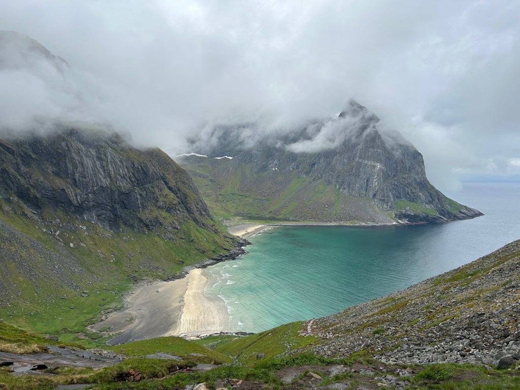
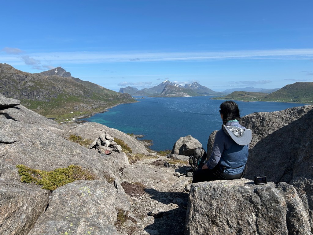
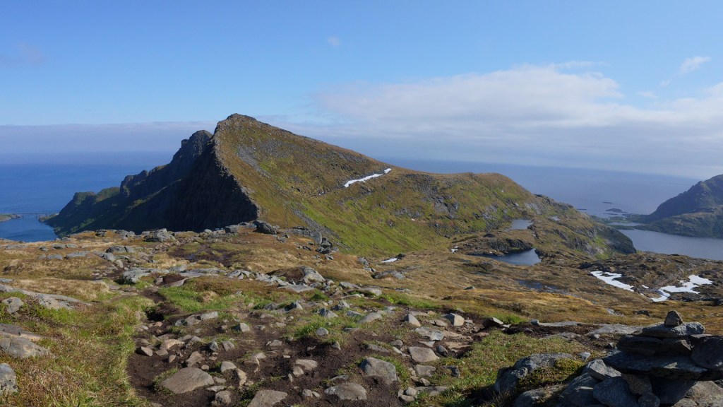
Midnight sun, jagged mountains, golden beaches and turquoise water: you simply can’t find them all in one place anywhere else on earth. The weather was abnormally mild for an archipelago completely within the artic circle, while the purity and tranquility unique to the far north lingered in every breath I took.
Why the long crossing?
Lofoten has grown in popularity over the years, and easy-to-access day hikes like Djevelporten has become unpleasantly crowded. The best way to get away from the crowd is to be on a multi-day hike, and the Lofoten Long Crossing, designed by Rando Lofoten is the only long-distance route I could find online, even though it’s unofficial and unmarked.
Planning & Preparation
I based my planning on the Cicerone guidebook Hiking in Norway – North. I had the paper version for at-home planning and the kindle version on my phone for trail use. I also loaded the accompanied GPX files to the offline map in Gaia app for navigation. For double security, I also carried the Calazo 1:50000 Turkart Lofoten in my backpack.
Logistics
I flew into Harstad/Narvik Airport, followed by a 3-hour bus ride to Svolvær. From there, a weekday-only bus took me to Delp via Fiskebøl, where I spent four hours waiting in the ferry terminal’s waiting room for a connecting bus. In retrospect, I should have started my trip on a weekday — that way, I wouldn’t have had to stay overnight in Svolvær and could have traveled from Narvik Airport to Delp in a single day.
Getting back from Å was much easier: a short bus ride to Moskenes, then a 3-hour ferry to Bodø, where I caught a flight back to Amsterdam.
The trail is interrupted by road sections on day 3 (Kleppstad) and day 5 (Leknes), and a ferry ride is required on day 9 (to Vinstad). These discontinuities are easy to manage, except for the 12.5 km stretch between Kleppstad and Vikjorda, where no public transportation is available. I was lucky enough to hitch a ride within 15 minutes, thanks to two kind Taiwanese tourists — who even made a 7-minute detour off the main E10 road for me.
Resupply & Accommodations
The trail passed towns and villages at least every two days, so resupply was easy. I found resupplying in the northern part easier because of larger towns like Svolvær and Lekenes along the way. From Lekenes onwards resupply options reduced to supermarkets or convenience stores.
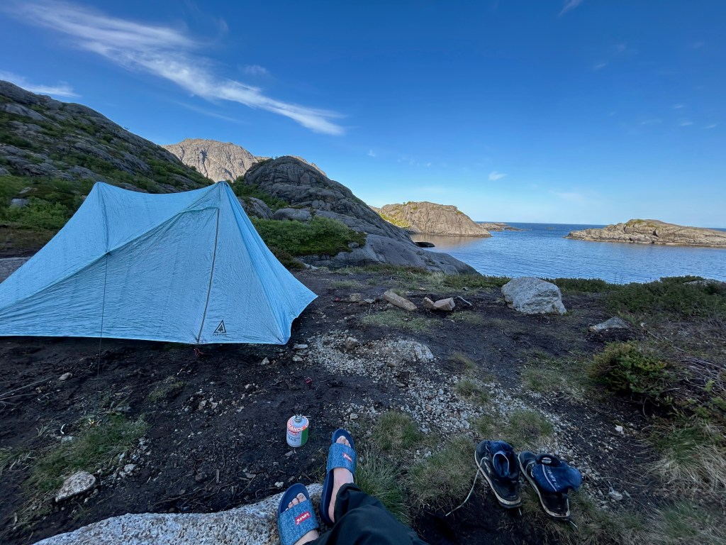
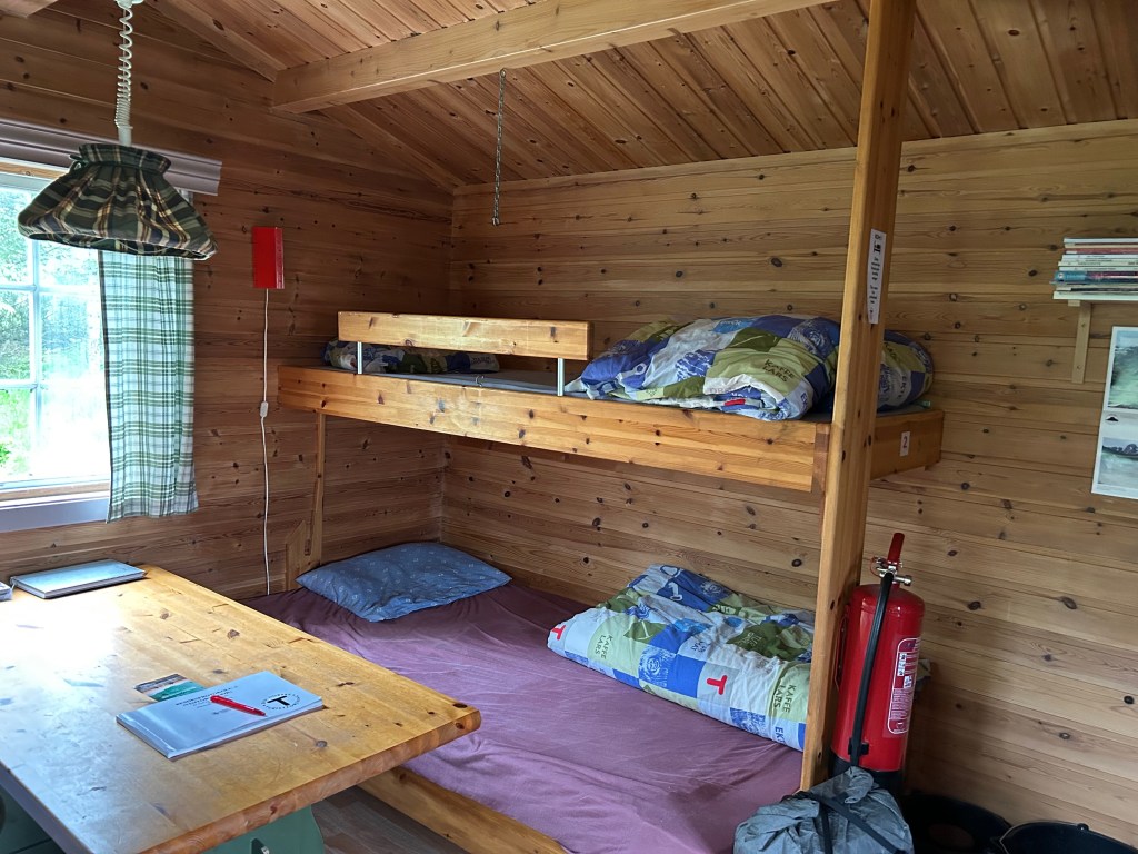
Regarding accommodation, I stayed in budget hotels (Svolvær, Leknes, Fredvang and Å), paid campsite in Sandsletta, unmanned cabin in Kvilebu, DNT hut Selfjordhytta, and wild camped for the rest of days.
One big disappointment from this trip was that I didn’t wild camp as much as I would have liked. The trail is designed to end each day near a town or village whenever possible. While this is convenient for resupplying, it’s not ideal for wild camping — I prefer not to pitch too close to human settlements. Pitching the tent was another challenge. The soil over Lofoten’s hard rock core is very thin, and I struggled to drive my MSR Groundhog stakes into the ground. Maybe I was being too picky, or just a bit paranoid about whether my flimsy-looking ultralight tent could hold up (it passed the test). Still, I wish I had camped more.


Weather & Trail condition
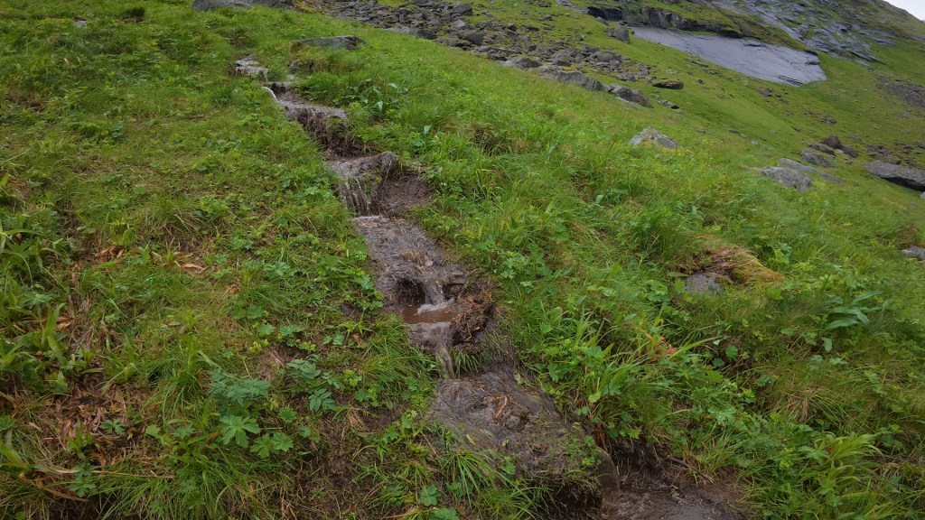
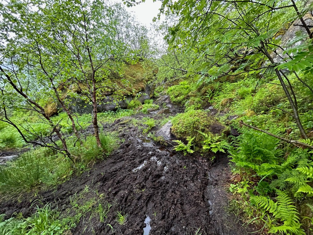
Lofoten is a thermal anomaly. During my stay, daytime temperatures hovered around 10°C, and at night they stayed just above freezing. It got significantly colder at higher elevations, especially with the wind, but I never felt as cold as I had while hiking in other parts of Norway — I still remember the summer hailstorm in Jotunheimen National Park. The wetness, however, was the most challenging part. The mist and rain wore on my morale, and the grass was always wet — rain or shine.
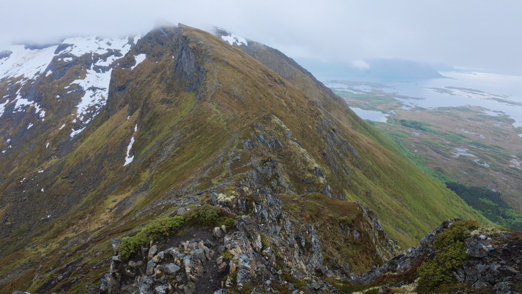
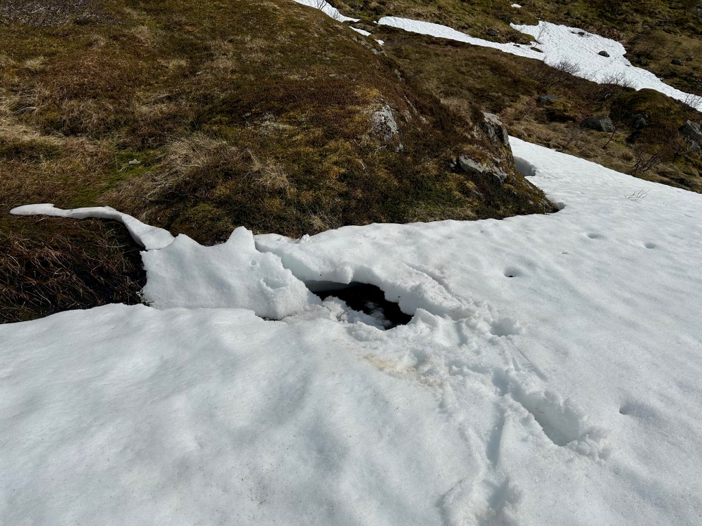
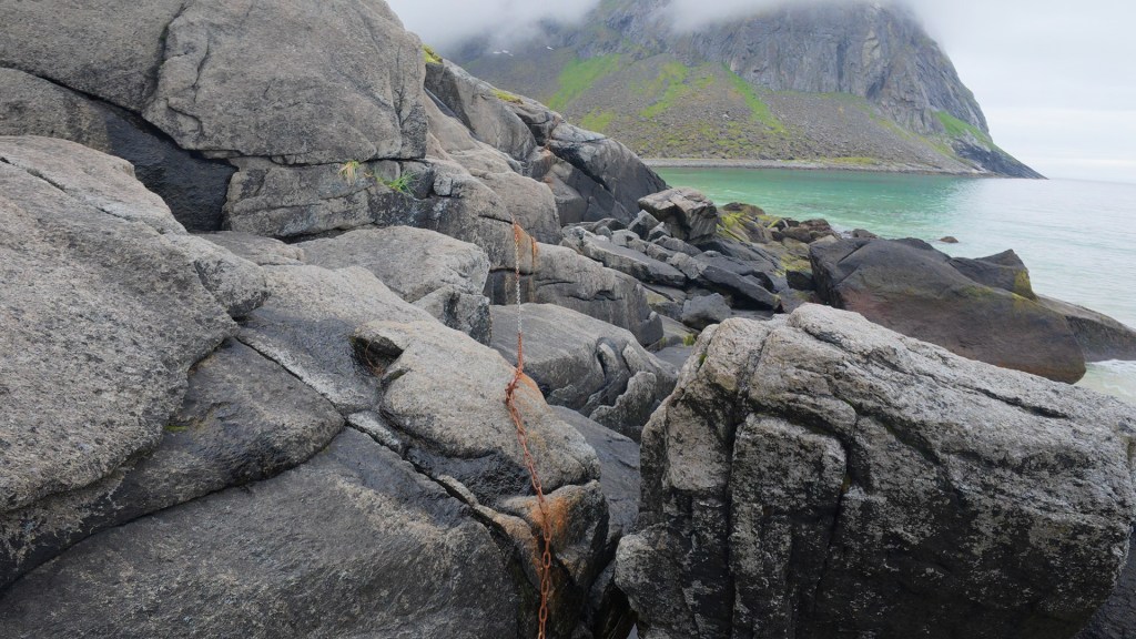
Trail conditions were my biggest complaint. The path was so muddy that I slipped multiple times a day. It was often overgrown with wet grass or covered in snow, which is why my boots stayed wet even on sunny days. I got sidetracked constantly due to the multitude of parallel and alternative routes, and I had to check my location on the Gaia app every half hour just to stay on track.

Animals
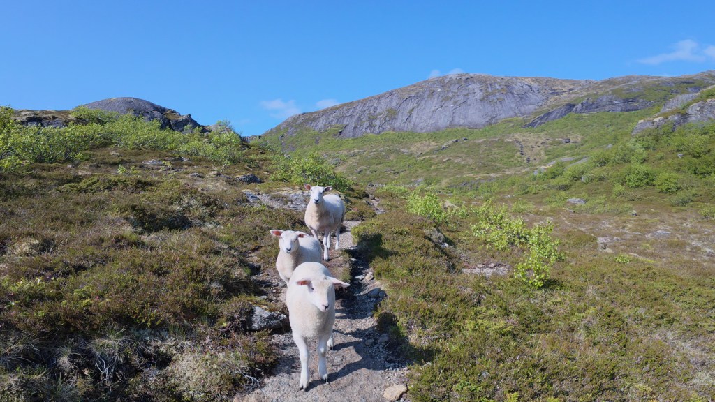
Sheep roam freely in Lofoten, and I encountered them almost every day. They were so fluffy and clean, as if they had walked straight out of an illustrated children’s book. They were used to people and only stepped aside at the last moment.
Birdlife is abundant. I’m no ornithologist, but I definitely spotted eagles in the mountains several times.

Is it hard or dangerous?
This is one of the most challenging long-distance trails I’ve hiked. The difficulty lies mainly in the terrain — wet, muddy, and slippery — as well as in poor trail design, with many steep, direct ascents and descents. Route finding added to the challenge: the path was often unclear, overgrown, or buried under snow. That said, this is by no means a technical hike. It doesn’t require mountaineering gear or climbing skills. Any hiker with steady footing and basic scrambling ability should be able to manage it.
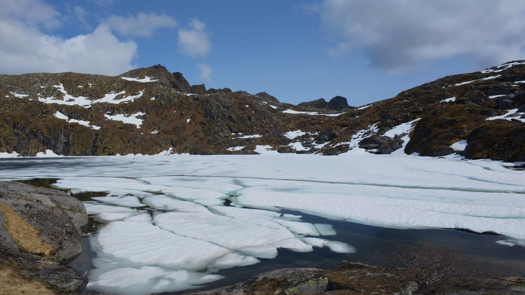
Dangerous? Not really, but there were definitely some heart pumping moments. The scariest moments included making the first marks on a steep, snow-covered slope overhanging a half-frozen lake, and traversing the headland at Kuhella near Kvalvika Beach.
Is it crowed?
Definitely not. During the first few days in the north I seldom encountered any other hikers, especially in the middle of a day’s hike. On the second and third day I literally had the mountains all to myself. I enjoyed the solicitude but was genuinely scared while traversing the snowfields alone. The footprints left by previous hikers were my only reassurance.
The trail became noticeably busier after Leknes, mostly with day hikers. The sections around the much-hyped Kvalvika Beach and Munkebu were particularly popular.
I didn’t meet many others doing the full Long Crossing — just three going in the opposite direction and three going the same way. The ones I remember most clearly were a PCT thru-hiker couple I met on day nine, waiting for the ferry at Kjerkfjorden — partly because the girl was carrying a 1-liter glass bottle of extra virgin olive oil in her ultralight pack.
Anything I didn’t like?
Not much. The poor trail conditions were my biggest complaint. I also wished there were more facilities for long-distance hikers. I really missed the fully equipped DNT huts with their three-course meals at the end of each day’s hike — a luxury I’d enjoyed in other Norwegian national parks. They made planning so much easier and were a true blessing in bad weather.
A tribute to human kindness
I was so grateful at Narvik Airport when another backpacker gave me his camping gas canister — something he couldn’t take on the plane. I had been stressed about finding fuel, since I arrived on a Saturday and the following Monday was a public holiday.
My pre-trip research suggested that locals weren’t keen on picking up hitchhikers. Fortunately, international tourists didn’t seem to share that view. In addition to the two kind Taiwanese tourists who saved me a 12.5 km road walk, I was offered a ride by a friendly American man and his German wife as I passed the supermarket in Ramberg.
The bus drivers — especially those on the local routes — were friendly and chatty. On day 1, the driver was kind enough to drop me directly at the trailhead car park. I also met some local hikers on day 6 who were curious about my trek and commented on the small size of my backpack. Long-distance walking clearly isn’t common in Lofoten. Most locals I met on the trail were runners, day hikers, or dog walkers.
If you want to know more
Check out my YouTube video documenting the entire hike, day by day.

Leave a comment